Who needs Google Street View when you can explore the famous passage tomb of Bryn Celli Ddu via Minecraft? In an interactive twist on the virtual tour, a new virtual version of Bryn Celli Ddu has been created which will allow young people to explore one of the most impressive Neolithic burial monuments of the British Isles from the safety of the living room. In this blog post, project co-director Dr Ben Edwards from Manchester Metropolitan University shares the process of creating the Minecraft world, with his daughter Bella Edwards, during the coronavirus lockdown.
This slideshow requires JavaScript.
Since 2015, alongside Dr Seren Griffiths, also of Manchester Metropolitan University, Dr Ffion Reynolds of Cadw, and Adam Stanford of Aerial Cam, I have been involved with the Bryn Celli Ddu public archaeology landscape project.
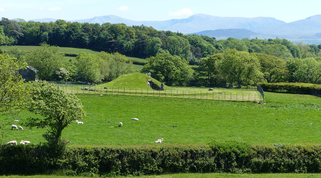
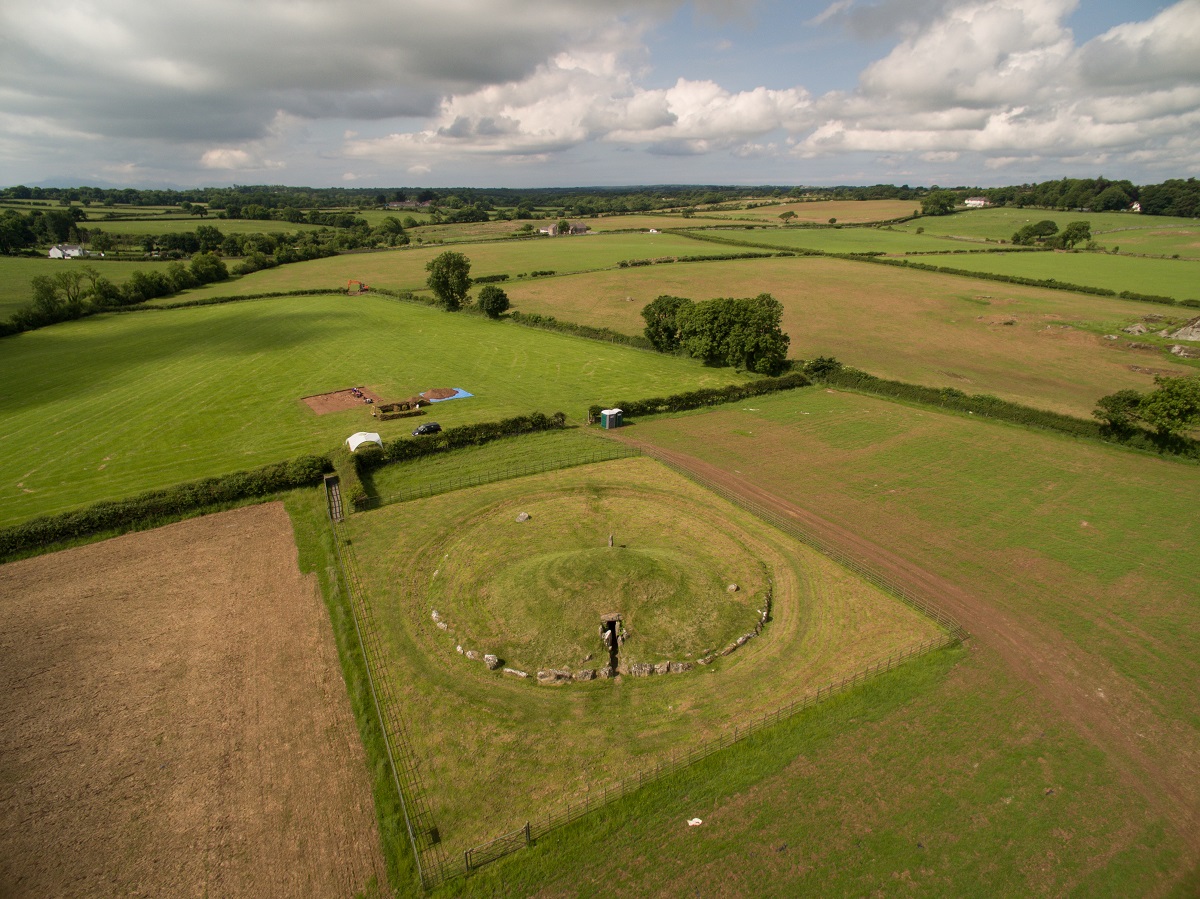
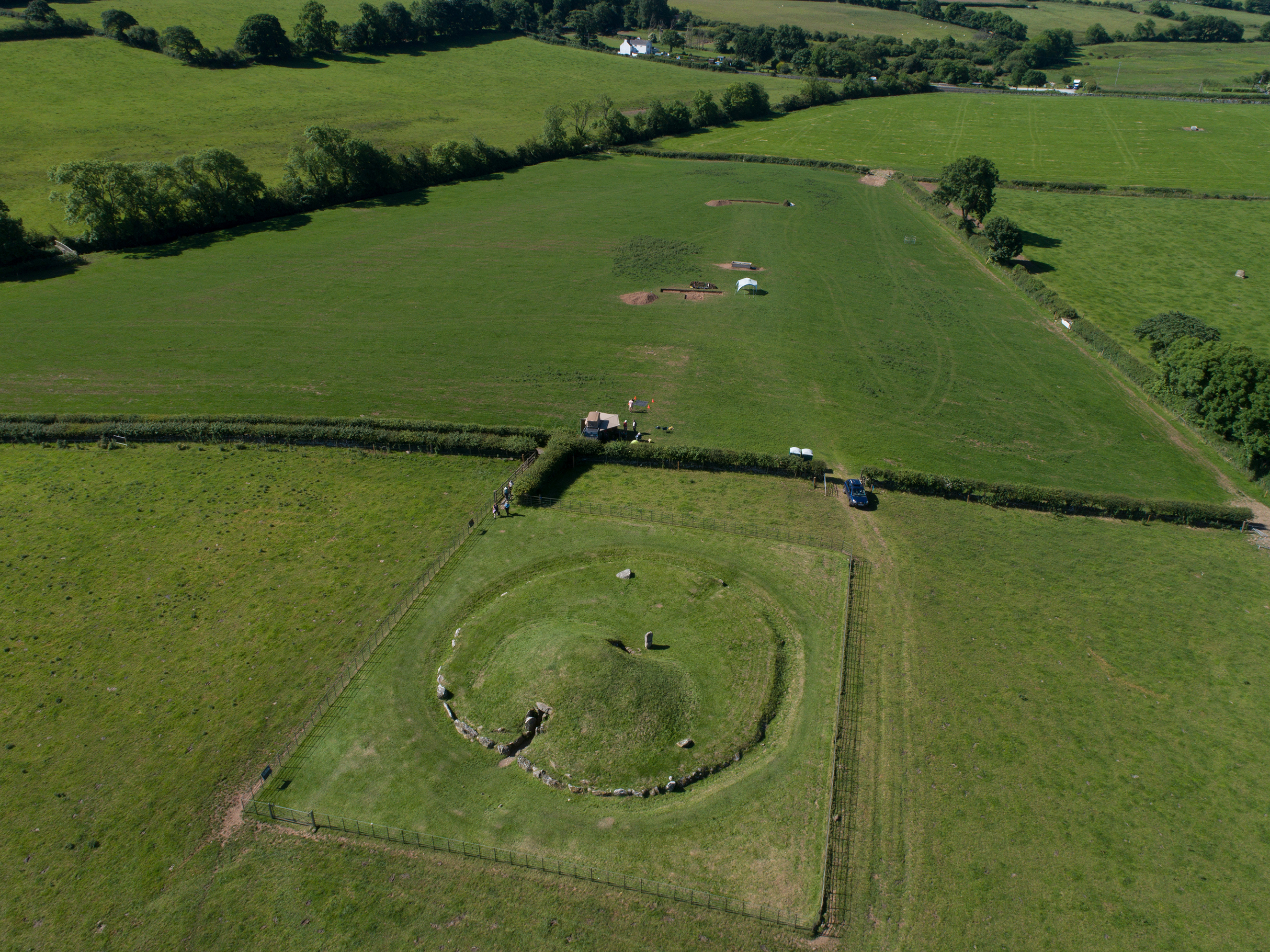
Bryn Celli Ddu is one of the most impressive Neolithic burial monuments in the British Isles: a passage tomb, consisting of a stone-built passage into an artificial earth mound, which terminates in a burial chamber. The passage tomb was used as a location for burial around 3000BC, but the site had a much longer history, and exists in a landscape replete with evidence for prehistoric ritual activity. Prior to the site’s use for burial, a henge monument with an internal stone circle occupied the site and given the 3000BC data associated with the later passage tomb, this would seem to be one of the earliest henge monuments in Wales.
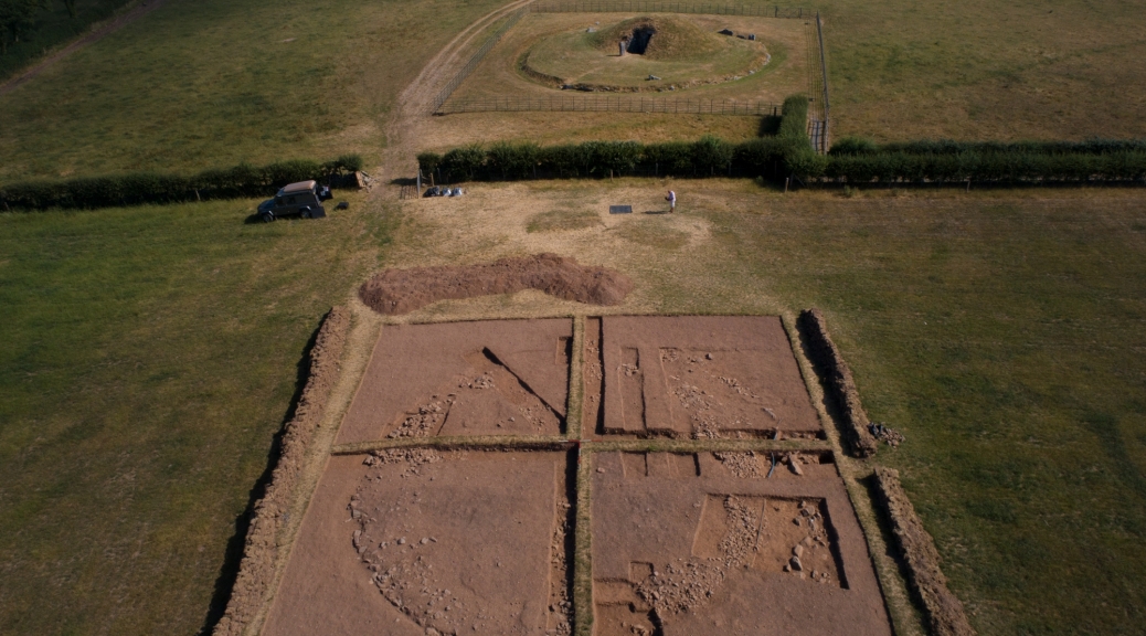
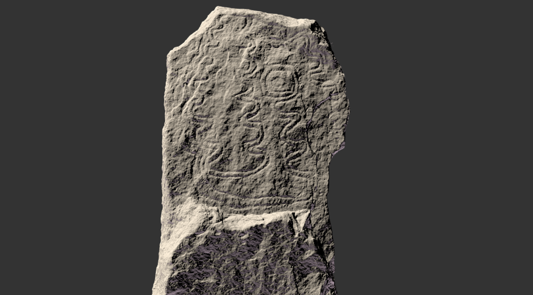
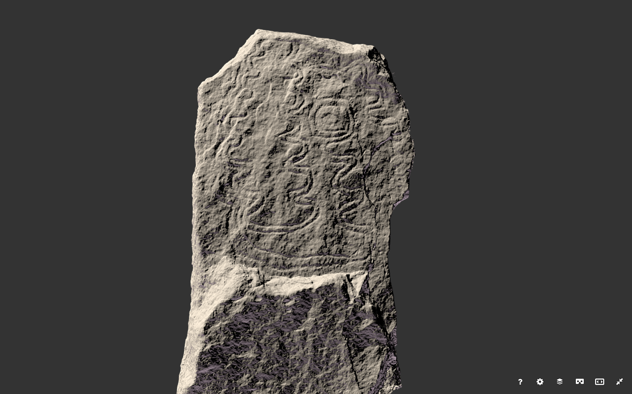
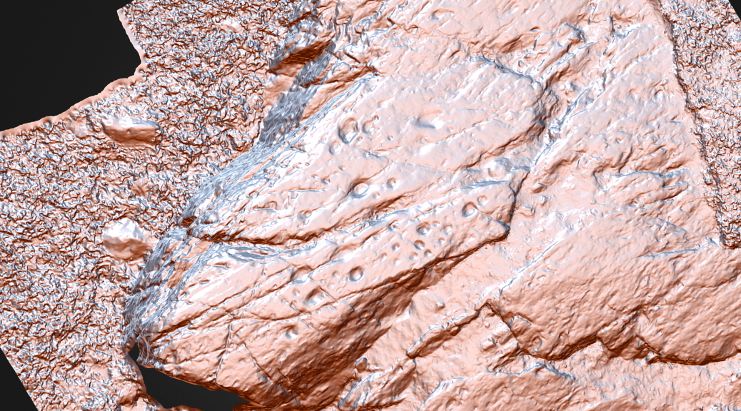
Our excavations during the project did not focus on the tomb itself, as this was excavated in the 1930s prior to its reconstruction and restoration. Instead, we set out to investigate the landscape around the monument, which had seen surprisingly little sustained investigation, despite the importance of the site. We have located new panels of Neolithic cup-marked rock art, demonstrated the existence of a later Early Bronze Age burial cairn cemetery to the south of the tomb, and located a cluster of later Neolithic Grooved Ware pits. The burial monument clearly led to the location being significant in prehistory after the use of the tomb itself had finished.
Bryn Celli Ddu is one of only three passage tombs in Wales, all of which are on Anglesey, but it is the only such monument with an association with midsummer solstice sunrise. The passage into the mound was deliberately aligned so that on the longest day of the year, as soon as the sun rose, it would shine down the passage and illuminate the burial chamber within.
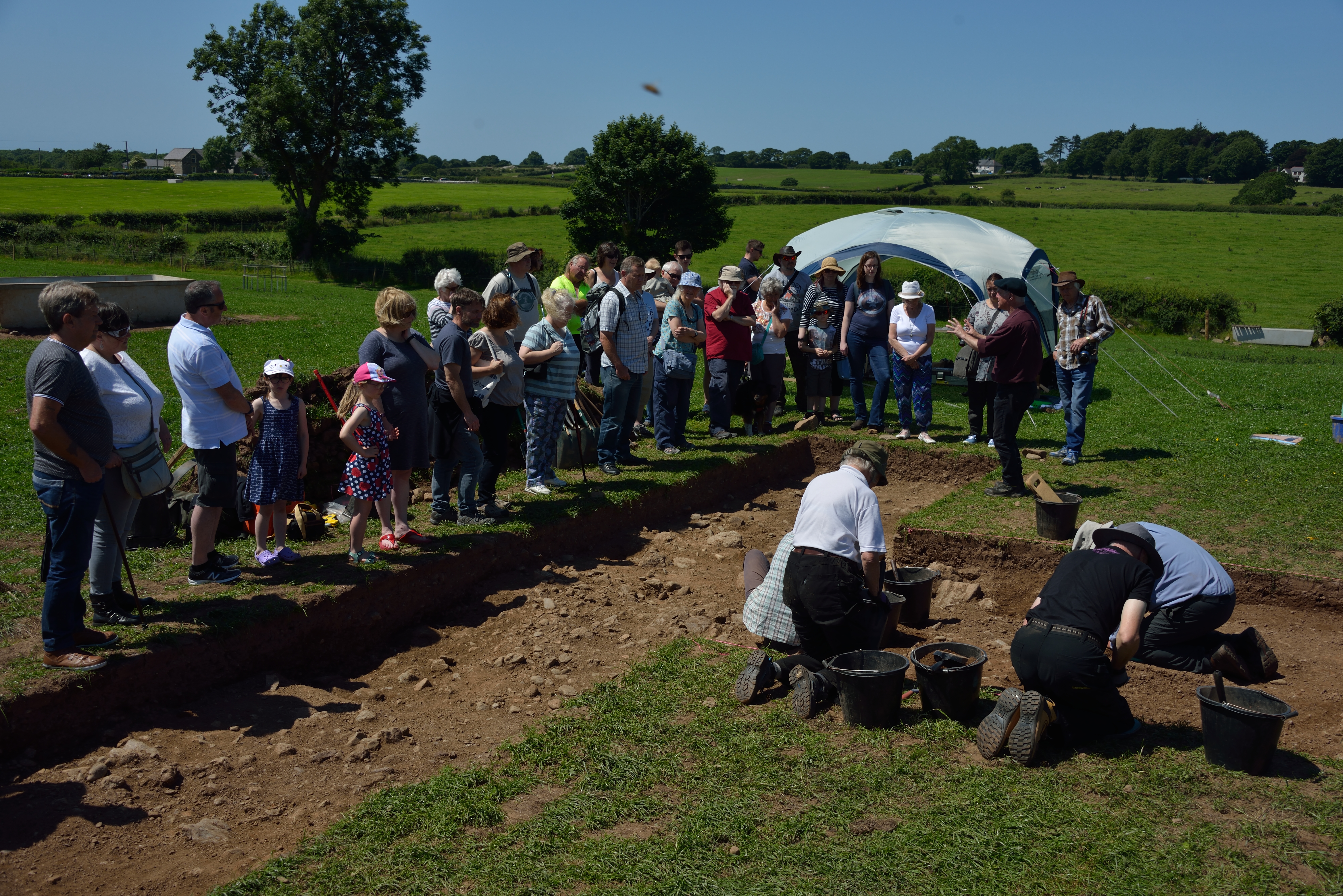
Of absolutely central importance to our project over the course of the last five years has been the involvement of the local community in all our research work. Every year, volunteer excavators have been part of the excavations; public open days have been held; school visits have taken place; a local prehistoric treasure hunt has been designed; along with a smartphone app for public use; and temporary exhibitions at Oriel Ynys Môn. However, with the introduction of the coronavirus lockdown, we were forced to cancel all our excavation, survey and outreach work for the 2020 season. Whilst this was a great shame, it did provide the opportunity for more imaginative ways of connecting people with the prehistoric past.
It seemed to me that a recreation of the Bryn Celli Ddu landscape would be the perfect way to get school children virtually to the site, even though the excavation and open days had been cancelled this year. Thus, by roping-in my now home-schooled daughter, we were able to embark upon a recreation of Bryn Celli Ddu and all the prehistoric features we had discovered or investigated over the five years of the project.
The most fundamental element of any landscape is the topography itself: the shape of the valley of the Afon Braint in which Bryn Celli Ddu is located. The monument was deliberately sited on a low sand and gravel knoll in the middle of the valley, presumably to provide local prominence and to avoid the boggier ground that surrounded the river and its tributary streams. These are now canalised, but aerial photography shows their previous courses in the form of palaeochannels.
Fortunately, using World Painter, a third-party Minecraft world creator, we were able to import an actual digital terrain model of the valley into Minecraft, to use as the base on which to build the world. This terrain model was accurate to 1m, having been derived from satellite lidar data, and the contours clearly showed the course of the river and tributary streams. ‘Painting’ the world as a first step also allowed the rapid creation of the rivers themselves, and the boggy areas that would have surrounded them in prehistory.
The new Bryn Celli Ddu Minecraft experience has now been made available by The Welsh Government, through its Hwb Cymru school’s portal, which provides free access for school children to the Education Edition of Minecraft. Schools across Wales, and the UK, can now download the world onto their Education Editions of Minecraft and allow pupils to access the experience.
The world takes the viewer on a journey through the Bryn Celli Ddu landscape, with its main passage tomb, the cairn cemetery, rock art panels and Neolithic house based on evidence at Llanfaethlu.
The Minecraft Experience is available for all versions of Minecraft but check which one you are using before you download.
For teachers and school children with access to Minecraft Education Edition:
Click Here for the Cymraeg version
Click Here for the English version
For users of the commercial (paid-for) edition of Minecraft click here
Instructions for installing and using Minecraft Worlds is available here
More information on the Minecraft project is available on the Manchester Centre for Public History and Heritage website: here
The Bryn Celli Ddu public archaeology landscape project is led by the Welsh Government’s historic environment service, Cadw and Manchester Metropolitan University.